Sunday, December 9, 2012

CU3AN(Azores) on 20m USB!!!

CU3AN(Azores) on 20m USB!!!

CU3AN Azores flag Azores JOSE GABRIEL ALVES
CANADA DO ROLO, 33
9700-713 TERRA-CHA - TERCEIRA Is.
Azores

[+] Mailing label
Lookups:   23145 Ham Member
Email: Use mouse to view.. QSL: CU3AN * BUREAU * LOTW

20121209 0945UTC 14260kHz CU3AN
Date : 09/Dec/2012 0945UTC 
Freq : 14260kHz USB 
Rig : SDR(PI4THT)
ANT : GP
PC recording

TERCEIRA Island 

 
 HAMRADIO SINCE 1985 Class A

 51598


Yaesu FT-1000MP MARK-V HF *** Cushcraft A3S *** 200W
Delta Loop 12m * 17m
ICOM-706MKII *** Cushcraft A505S *** Diamond 50HS-2HB
Kenwood TS-130S *** DUMMY LOAD MFJ-264 1,5KW

*** DX4WIN Log *** LoTW *** NOVA4WIN **** APRS ****

WAC - January 02, 1990

DXCC - August 09, 1993 Nº.20.662

WAS - August 09, 1993 Nº.47.102

WAZ - May 31, 1994 Nº.4166

IOTA - July 29,1995 Nº.965

WPX - August 15, 2012 Nº.3168


IMPORTANT about QSLING:

QSL Direct use standard airmail envelopes with 1 IRC or EQUIVALENT


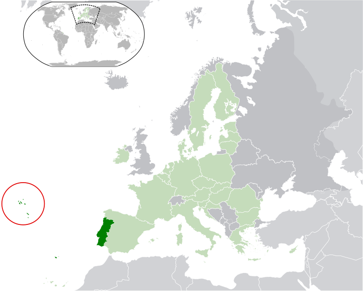
The Archipelago of the Azores (UK /əˈzɔrz/ ə-zorzUS /ˈzɔrz/ ay-zorzPortugueseAçoresIPA: [ɐˈsoɾɨʃ]) is composed of nine volcanic islands situated in the North Atlantic Ocean, and is located about 1,500 km (930 mi) west of Lisbon and about 1,900 km (1,200 mi) southeast of Newfoundland. The islands, and their Exclusive Economic Zone, form the Autonomous Region of the Azores, one of the twoautonomous regions of Portugal. Its main industries are agriculture, dairy farming (for cheese and butter products primarily), livestock ranchingfishing, and tourism, which is becoming the major service activity in the region. In addition to this, the government of the Azores employs a large percentage of the population directly or indirectly in many aspects of the service and tertiary sectors.
There are nine major Azores islands and an islet cluster, in three main groups. These are Flores andCorvo, to the west; GraciosaTerceiraSão JorgePico, and Faial in the centre; and São MiguelSanta Maria, and the Formigas Reef to the east. They extend for more than 600 km (370 mi) and lie in a northwest-southeast direction.
The vast extent of the islands defines an immense exclusive economic zone of 1,100,000 km2(420,000 sq mi). The westernmost point of this area is 3,380 km (2,100 mi) from the North American continent. All the islands have volcanic origins, although some, such as Santa Maria, have had no recorded activity since the islands were settled. Mount Pico, on the island of Pico, is the highest point in Portugal, at 2,351 m (7,713 ft). The Azores are actually some of the tallest mountains on the planet, measured from their base at the bottom of the ocean to their peaks, which thrust high above the surface of the Atlantic.
Because these once-uninhabited and remote islands were settled sporadically over a span of two centuries, their culture, dialect, cuisine, and traditions vary considerably.


9G5SW(Ghana) on 20m USB!!!

9G5SW(Ghana) on 20m USB!!!

9G5SW Ghana flag Ghana Walter Spaeth
P.O.BOX 2263 SY
Sunyani B/A
Ghana

[+] Mailing label
Lookups:   24436 Ham Member
Email: Use mouse to view.. QSL: EQSL.CC, OR DIRECT PLS. NO MORE VIA OK1DOT


20121209 0930UTC 14322kHz 9G5SW
Date : 09/Dec/2012 0930UTC 
Freq : 14322kHz USB 
Rig : SDR(PI4THT)
ANT : GP
PC recording


Please note OK1DOT is no more my QSL manager. pls send your card direct to my post box in Sunyani
Please visit my webside: machines2000.de
Please Note: 9G5SW does not respond to people who call using only their suffix.
Good operating tip would be to give your full callsign once, then listen 4-5 seconds to see if I have heard you or am replying to someone else before you make a second call.
I consider stations who call - call - call repeatedly without pausing to listen to be QRMers and run the risk of being ignored.

I am a supporter of the DX Code of Conduct:
I will listen and listen and listen again before I callinig.
I will only call if I can copy the DX-Station properly.
I will not trust the DX cluster and will be sure of the DX station's call sign before calling.
I will not interfere with the DX station nor anyone calling and will never tune up on the DX frequency or in the QSX slot.
I will wait for the DX station to end a contact before I call.
I will always send my full call sign.
I will call and then listen for a reasonable interval. I will not call continuously.
I will not transmit when the DX operator calls another call sign, not mine.
I will not transmit when the DX operator queries a call sign not like mine.
I will not transmit when the DX station requests geographic areas other than mine.
When the DX operator calls me, I will not repeat my call sign unless I think he has copied it incorrectly.
I will be thankful if and when I do make a contact.
I will respect my fellow hams and conduct myself so as to earn their respect.

Please note OK1DOT is no more my QSL manager. Pls send your card direct to my post box in Sunyani


Ghana Listeni/ˈɡɑːnə/, officially the Republic of Ghana, is a country in West Africa. It is bordered by Ivory Coast to the west, Burkina Faso to the north, Togo to the east, and the Gulf of Guinea to the south. The word Ghana means "Warrior King",[6] the title accorded the kings of the ancient and medieval Ghanaian Empire.
Ghana was inhabited in pre-colonial times by a number of ancient predominantly Akan kingdoms, including the inland Ashanti Empire, the Akwamu, the Akyem, the Bonoman, the Denkyira, and the Fante among others. Prior to contact with Europeans trade between the Akan and various African states flourished due to Akan gold wealth. Trade with European states began after contact with the Portuguese in the 15th century, and the British established the Gold Coast Crown colony in 1874 over parts but not all of the country.[7]
The Gold Coast achieved independence from the United Kingdom in 1957,[8] becoming the first sub-Saharan African nation to do so, from European colonialism.[9][10] The name Ghana was chosen for the new nation to reflect the ancient Empire of Ghana, which once extended throughout much of west Africa.
Ghana is a member of the South Atlantic Peace and Cooperation Zone, the United Nations, theCommonwealth of Nations, the African Union, the Economic Community of West African States, and an associate member of La Francophonie. Ghana is one of the largest cocoa producers in the world[11] and is also home to Lake Volta, the largest artificial lake in the world by surface area.[12]

GM4SID(Scotland) on 20m CW!!!

GM4SID(Scotland) on 20m CW!!!

GM4SID Scotland flag Scotland SIDNEY WILL
53 BISHOP FORBES CRESCENT
Blackburn, ABERDEEN AB21 0TW
Scotland

[+] Mailing label
Lookups:   9087 Ham Member
Email: Use mouse to view.. 


20121209 0823UTC 14052.4kHz GM4SID
Date : 09/Dec/2012 0823UTC 
Freq : 14052.4kHz USB 
Rig : SDR(PI4THT)
ANT : GP
PC recording

6V1A(Senegal) on 20m USB!!!

6V1A(Senegal) on 20m USB!!!

QSL image for 6V1A
6V1A Senegal flag Senegal IOTA AF-045 Expedition of Goree Island
P.O.BOX 971
DAKAR
Senegal

[+] Mailing label
Lookups:   5593
QSL: 6W6JX


20121209 0807UTC 14260kHz 6V1A
Date : 09/Dec/2012 0807UTC 
Freq : 14260kHz USB 
Rig : KENWOOD TS-590S
ANT : LOOP
PC recording

...............................................................................

Lookups5593 (6092)
Last Update2003-05-31 05:28:39
Geo SourceFrom DXCC
Bearing323.5° NW (from JJ5IZX)
Distance8511.5 mi (13697.9 km)
Long Path16345.4 mi (26305.3 km)
Sunrise07:13:52 UTC
Sunset18:29:51 UTC
Web Pagehttp://www.radio6w.org/
QSL Info6W6JX
Apply for a new Vanity callsign...

UA2FR(Kaliningrad) on 20m CW!!!

UA2FR(Kaliningrad) on 20m CW!!!

QSL image for UA2FR
UA2FR Russia flag Russia Valentin V. Kashaev
ul. Krylova 5-A-60
Zelenogradsk, Kaliningradskaya obl. 238530
Russia

[+] Mailing label
Lookups:   59663 Ham Member
 QSL: BUREAU - DIRECT - LOTW


Lookups59663 (71898)
QRZ AdminUA2FR
Last Update2011-05-10 20:17:34
Latitude54.943574 (54° 56' 36'' N)
Longitude20.417522 (20° 25' 3'' E)
Grid SquareKO04fw
Geo SourceUser supplied
Bearing327.0° NNW (from JJ5IZX)
Distance5174.2 mi (8327.1 km)
Long Path19682.6 mi (31676.1 km)
Sunrise06:49:41 UTC
Sunset14:11:05 UTC
ITU Zone29
CQ Zone15
QSL InfoBUREAU - DIRECT - LOTW
QSL by Mail?Yes (e.g. Will this ham QSL by Postal Mail?)
QSL by eQSL?No (e.g. Will this ham QSL with eQSL?)
Uses LOTW?Yes (e.g. Does this ham use ARRL's LOTW ?)
Admin For(1) UA2FR
Apply for a new Vanity callsign...


20121209 0753UTC 14038kHz UA2FR
Date : 09/Dec/2012 0753UTC 
Freq : 14038kHz CW 
Rig : KENWOOD TS-590S
ANT : LOOP
PC recording


OD5PY(Lebanon) on 20m RTTY!!!

OD5PY(Lebanon) on 20m RTTY!!!

OD5PY Lebanon flag Lebanon Marwan Lammam
(qsl via KU9C)
Beirut
Lebanon

[+] Mailing label
Lookups:   96372 XML Subscriber
QSL: LOTW/ EQSL/QRZ MONTHLY UPLOAD; QSL MGR: KU9C; NO BUREAU


20121209 0705UTC 14084kHz OD5PY
Date : 09/Dec/2012 0705UTC 
Freq : 14084kHz RTTY
Rig : SDR(PI4THT) 
ANT : GP
PC recording


The Basics:
  • Yaesu FT-897D
  • Heil pse-6
  • Cushcraft A3S Beam; R-7000 Vert.; 13B2 Beam
  • Alpha Delta DX-LB Dipole
  • Tokyo Hy-Power HL-450B
  • License since 1994
  • Swl since 1985
  • Born 1971
  • Raise Awareness about Autism: www.aasilebanon.org


Lebanon (Listeni/ˈlɛbənɒn/ or /ˈlɛbənən/Arabicلبنان‎ Libnān or LubnānLebanese Arabic: [lɪbˈneːn]), officially theLebanese Republic[nb 1] (Arabicالجمهورية اللبنانية‎ Al-Jumhūrīyah Al-LibnānīyahLebanese Arabic: [elˈʒʊmhuːɾɪjje l.ˈlɪbneːnɪjje]), is a country in the East Mediterranean. It is bordered by Syria to the north and east and Israelto the south. Lebanon's location at the crossroads of the Mediterranean Basin and the Arabian hinterlandhas dictated its rich history and shaped a cultural identity of religious and ethnic diversity.[6]
The earliest evidence of civilization in Lebanon dates back more than seven thousand years, predatingrecorded history.[7] Lebanon was the home of the Phoenicians, a maritime culture that flourished for over a thousand years (c.1550–539 BC). The region, like the rest of Syria, came under the rule of the Roman Empire, and eventually one of the Empire's leading centers of Christianity. In the Mount Lebanon range a monastic tradition known as the Maronite Church was established. As the Arab Muslims conquered the region, the Maronites held onto their religion and identity. However, a new religious group, the Druze, established themselves in Mount Lebanon as well, a religious divide that would last for centuries. During theCrusades the Maronites established strong ties with the Roman Catholic invaders, ties that influenced the region into the modern era.
The region eventually came under the rule of the Ottoman Empire, a situation that lasted for centuries. Following the collapse of the Empire after World War I, the five provinces that constitute modern Lebanon were mandated to France. The French expanded the borders of Mount Lebanon, which was mostly populated by Maronites and Druze, to include more Muslims. Lebanon gained independence in 1943, establishing a unique political system – "confessionalism" – that is a power-sharing mechanism based on religious communities. Bechara El Khoury (independent Lebanon's first President) and Riad El-Solh(Lebanon's first Prime Minister) are considered the founders of the modern Republic of Lebanon and are national heroes for having led the country's independence. French troops withdrew from Lebanon in 1946.[8]
Before the Lebanese Civil War (1975–1990), the country experienced a period of relative calm and prosperity, driven by tourism, agriculture, and banking.[9] Because of its financial power and diversity, Lebanon was known in its heyday as the "Switzerland of the East".[10] It attracted large numbers of tourists,[11] such that the capital Beirut was referred to as "Paris of the Middle East." At the end of the war, there were extensive efforts to revive the economy and rebuild national infrastructure.[12]