
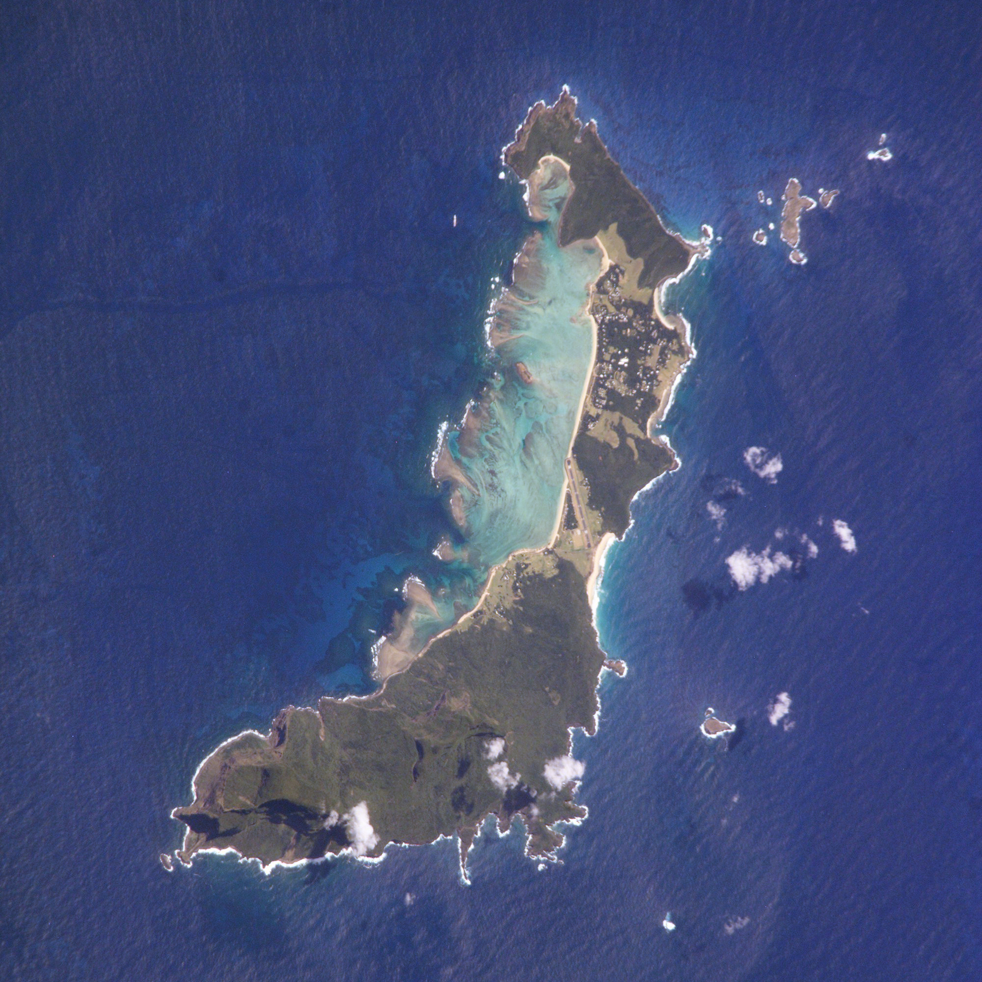
Lord Howe Island ( /ˈhaʊ/, locally /ˈhæɔ/) (formerly Lord Howe's Island) is an irregularly crescent-shaped volcanic remnant in the Tasman Sea between Australia and New Zealand, 600 kilometres (370 mi) directly east of mainland Port Macquarie, and about 900 kilometres (560 mi) from Norfolk Island. The island is about 10 km long and between 2.0 km and 0.3 km wide with an area of 14.55 km2, "of which only 398 hectares is in the lowland settled area".[6] Along the west coast there is a sandy semi-enclosed sheltered coral reef lagoon. Most of the population lives in the north, while the south is dominated by forested hills rising to the highest point on the island, Mount Gower(875 m or 2,871 ft).[7] The Lord Howe Island Group of islands[7] comprises 28 islands, islets and rocks. Apart from Lord Howe Island itself the most notable of these is the volcanic and uninhabited Ball's Pyramid about 23 km to the south-east. To the north there is the Admiralty Group, a cluster of seven small uninhabited islands.[8]
The first reported sighting of Lord Howe Island was on 17 February 1788 when Lieutenant Henry Lidgbird Ball, commander of the Armed Tender HMS Supply was on its way from Botany Bay to found a penal settlement on Norfolk Island.[9] On the return journey Ball sent a party ashore on Lord Howe Island to claim it as a British possession.[10] It subsequently became a provisioning port for the whaling industry,[11] and was permanently settled in June 1834.[12] When whaling declined, the worldwide export of the endemic kentia palms began in the 1880s,[13]which remains a key component of the Island's economy. The other continuing industry, tourism, began after World War II.
The Lord Howe Island Group is part of the state of New South Wales[14] that, for legal purposes, is regarded as anunincorporated area administered by the Lord Howe Island Board[14] which reports to the New South Wales Minister for Environment and Heritage.[14] The island's standard time zone is UTC+10:30, or UTC+11 when daylight saving time applies.[15] The currency is the Australian dollar. Commuter airlines are linked to Sydney, Brisbane, Port Macquarie and Norfolk Island.
The Lord Howe Island Group is recorded by UNESCO as a World Heritage Site of global natural significance.[16]Most of the island is virtually untouched forest with many of the plants and animals found nowhere else in the world. Other natural attractions include the diversity of its landscapes, the variety of upper mantle and oceanic basalts, the world's southernmost barrier coral reef, nesting seabirds, and its rich historical and cultural heritage.[17] The Lord Howe Island Act of 1981 established a "Permanent Park Preserve" (covering approximately 70 per cent of the island).[15] The surrounding waters are a protected region designated the Lord Howe Island Marine Park.[18]

Active on 160-6 mtrs CW, SSB, RTTY.
They will also participate CQ WW DX Contest CW in two single band category.
20121116 0817UTC 14002.5kHz VK9/OH1VR
Date : 16/Nov/2012 0817UTC
Freq : 14002.5kHz CW
Rig : ICOM IC-7200
ANT : LOOP
PC recording
No comments:
Post a Comment