7P8D
P O Box 29169 Sunridge Park 6008 South Africa [+] Mailing label | ||
Lookups: 40059
| ||
| Email: Use mouse to view.. QSL: DIRECT AS PER WEBSITE | ||
20m用のアンテナなのでGain不足です。
非常に薄い信号ですが、なんとか聞き取れるレベルです。
20121128 2008UTC 7026kHz 7P8D
Date : 28/Nov/2012 2008UTC
Freq : 7026kHz CW
Rig : ICOM IC-7200
ANT : LOOP(for 20m not enough gain)
PC recording
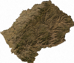
Lesotho (
Geography
Main article: Geography of Lesotho
Lesotho covers 30,355 km2 (11,720 sq mi). It is the only independent state in the world that lies entirely above 1,000 metres (3,281 ft) in elevation. Its lowest point of 1,400 metres (4,593 ft) is thus the highest in the world. Over 80% of the country lies above 1,800 metres (5,906 ft). Lesotho is also the southernmost landlocked country in the world and is entirely surrounded by the country of South Africa. It lies between latitudes 28° and 31°S, and longitudes 27° and 30°E.
[edit]Climate
Main article: Climate of Lesotho
Because of its altitude, Lesotho remains cooler throughout the year than other regions at the same latitude. Most of the rain falls as summer thunderstorms. Maseru and surrounding lowlands often reach 30 °C (86 °F) in summer. Winters can be cold with the lowlands getting down to −7 °C (19 °F) and the highlands to −18 °C (−0 °F) at times. Snow is common in the highlands between May and September; the higher peaks can experience snowfalls year-round.


No comments:
Post a Comment