Friday, December 7, 2012

YY4DNN(Venezuela) on 40m LSB!!!

YY4DNN(Venezuela) on 40m LSB!!!

QSL image for YY4DNN
YY4DNN Venezuela flag Venezuela Daniel Nunes Nuñez
VLN 81123 2250 Nw 114 th Ave. UNIT 1V
Miami Florida, FL 33172
USA

[+] Mailing label
Lookups:   26310 Platinum Subscriber
Email: Use mouse to view.. QSL: PLEASE " DIRECT" NO $ NO IRC


20121207 0645UTC 7143kHz YY4DNN
Date : 07/Dec/2012 0645UTC 
Freq : 7002kHz LSB 
Rig : SDR(PI4THT) 
ANT : GP
PC recording


"QSL via DIRECT 100 % Confirm" NO USD $ NO IRC
Dear friends Thank you very much for the QSO, and your interest in my station. To me your QSL is important. If you send me directly, I will send mine in the same way. --- 100% confirm the QSL via direct. The Courier in Venezuela is very slow, send your QSL to my address in Miami Florida USA. their Qsl will be in one week in my hands in Venezuela. no send money and no IRC. I'll be answering your Qsl as quickly if possible send your envelope self-addressed .I'll be waiting for your QSL
I'm always in HF Active 80-40-15-10 6 meters SSB and Digital Mode
hello friends, my website is still under construction. keep checking back because it will be soon! Thank you. 73!! .

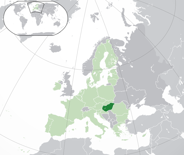
Local Time Venezuela
Venezuela (Listeni/ˌvɛnəzˈwlə/ ven-uh-zwale-uhlocally: [βeneˈswela]), officially called the Bolivarian Republic of Venezuela[1] (SpanishRepública Bolivariana de Venezuela [reˈpuβlika βoliβaˈɾjana ðe βeneˈswela]), is a country on the northern coast of South America. Venezuela's territory covers around 916,445 square kilometres (353,841 sq mi) with an estimated population of 29,105,632. Venezuela is considered a state with extremely high biodiversity, with habitats ranging from the Andes mountains in the west to theAmazon Basin rainforest in the south, via extensive llanos plains and Caribbean coast in the center and the Orinoco River Delta in the east.
Venezuela was colonized by Spain in 1522 despite resistance from indigenous peoples. It became the first Spanish American colony to declare independence (in 1811), but did not securely establish independence until 1821 (as a department of the federal republic of Gran Colombia, gaining full independence in 1830). During the 19th century Venezuela suffered political turmoil and dictatorship, and it was dominated by regional caudillos (military strongmen) well into the 20th century. The country has intermittently had democratic governments between 1945 and the present day; like most countries of Latin America, it has suffered some coups and military dictatorships. Economic shocks in the 1980s and 1990s led to a political crisis causing up to 3,000 deaths in the Caracazo riots of 1989, two attempted coups in 1992, and the impeachment of President Carlos Andrés Pérez for embezzlement of public funds in 1993. A collapse in confidence in the existing parties saw the 1998 election of former career officer Hugo Chávez, and the launch of the Bolivarian Revolution, beginning with a 1999 Constituent Assembly to write a newConstitution of Venezuela.
Venezuela is a federal presidential republic consisting of 23 states, the Capital District (covering Caracas), and Federal Dependencies (covering Venezuela's offshore islands). Venezuela claims all Guyanese territory west of the Essequibo River; this 159,500 square kilometres (61,583 sq mi) tract was dubbedGuayana Esequiba or the Zona en Reclamación (the "zone being reclaimed").[5]
Venezuela is among the most urbanized countries in Latin America;[6][7] the vast majority of Venezuelans live in the cities of the north, especially in the capital, Caracas, which is also the largest city. Since the discovery of oil in the early 20th century, Venezuela has been one of the world's leading exporters of oil and has the largest oil reserves. Previously an underdeveloped exporter of agricultural commodities such as coffee and cocoa, oil quickly came to dominate exports and government revenues. The 1980s oil glutled to an external debt crisis and a long-running economic crisis, which saw inflation peak at 100% in 1996and poverty rates rise to 66% in 1995[8] as (by 1998) per capita GDP fell to the same level as 1963, down a third from its 1978 peak.[9] The recovery of oil prices after 2001 boosted the Venezuelan economy and facilitated social spending, although the fallout of the 2008 global financial crisis saw a renewed economic downturn.

HA6NF(Hungary) on 20m USB!!!

HA6NF(Hungary) on 20m USB!!!

HA6NF Hungary flag Hungary JOZSEF SZABO
PF:66
SALGOTARJAN H-3101
Hungary

[+] Mailing label
Lookups:   20763
Email: Use mouse to view.. 


Lookups20763 (24797)
Last Update2001-09-03 10:26:51
Geo SourceFrom DXCC
Bearing321.6° NW (from JJ5IZX)
Distance5540.9 mi (8917.2 km)
Long Path19315.9 mi (31086.0 km)
Sunrise06:16:53 UTC
Sunset14:52:54 UTC
Apply for a new Vanity callsign...


20121207 0730UTC 14207kHz HA6NF
Date : 07/Dec/2012 0730UTC 
Freq : 14207kHz USB 
Rig : ICOM IC-7200 (JJ5IZX's station)
ANT : LOOP
PC recording


20121207 0731UTC 14207kHz HA6NF
Date : 07/Dec/2012 0731UTC 
Freq : 14207kHz USB 
Rig : SDR(PI4THT)
ANT : GP
PC recording


Hungary Listeni/ˈhʌŋɡəri/ (HungarianMagyarország [ˈmɒɟɒrorsaːɡ] ( listen)) is a landlocked country inCentral Europe.[6] It is situated in the Carpathian Basin and is bordered by Slovakia to the north,Ukraine, and Romania to the east, Serbia, and Croatia to the south, Slovenia to the southwest andAustria to the west. The country's capital, and largest city, is Budapest. Hungary is a member of theEuropean UnionNATO, the OECD, the Visegrád Group, and is a Schengen state. The official languageis Hungarian, also known as Magyar, which is part of the Finno-Ugric group and is the most widely spoken non-Indo-European language in the European Union.[7]
Following a Celtic (after c. 450 BC) and a Roman (AD 9 – c. 430) period, the foundation of Hungary was laid in the late 9th century by the Hungarian prince Árpád, whose great-grandson Saint Stephen I was crowned with a crown sent by the pope from Rome in 1000 AD. The Kingdom of Hungary existed for 946 years,[note 1] and at various points was regarded as one of the cultural centres of the Western world.[8][9] After about 150 years of partial Ottoman occupation (1541–1699), Hungary was integrated into the Habsburg Monarchy, and later constituted half of the Austro-Hungarian dual monarchy (1867–1918). A great power until the end of World War I, Hungary has lost about 70 percent of its territory, along with one third of its ethnically Hungarian population,[10] and all its sea ports under the Treaty of Trianon,[11] the terms of which have been considered excessively harsh by many in Hungary.[12] The kingdom was succeeded by an authoritarian regime, and then a Communist era (1947–1989) during which Hungary gained widespread international attention during the Revolution of 1956 and the seminal opening of its border with Austria in 1989, thus accelerating the collapse of the Eastern Bloc. The present form of government is a parliamentary republic, which was established in 1989. Today, Hungary is a high-income economy.[13]
Hungary is one of the thirty most popular tourist destinations in the world, attracting 10.2 million tourists a year (2011).[14] The country is home to the largest thermal water cave system[15] and the second largest thermal lake in the world (Lake Hévíz), the largest lake in Central Europe (Lake Balaton), and the largest natural grasslands in Europe (Hortobágy).

P40CX(Aruba) on 40m CW!!!

P40CX(Aruba) on 40m CW!!!

P40CX Aruba flag Aruba 
Thomas P. Roscoe K8CX
857 Albright McKay Road NE
Brookfield, OH 44403
USA

[+] Mailing label
Lookups:   4012
Email: Use mouse to view.. QSL: VIA K8CX DIRECT OR BUREAU


My P40CX operation from Aruba is from December 3 to December 10, 2012 which includes the ARRL 10 Meter contest.
QSL via my home call K8CX, direct or via the bureau.


20121207 0618UTC 7005kHz P40CX
Date : 07/Dec/2012 0618UTC 
Freq : 7005kHz CW 
Rig : SDR(PI4THT) 
ANT : GP
PC recording

..............................................................................................

Aruba (play /əˈrbə/ ə-roo-bəDutch pronunciation: [aˈruba]) is a 33-kilometer-long (20 mi) island of theLesser Antilles in the southern Caribbean Sea, located 27 km (17 mi) north of the coast of Venezuela and approximately 130 km (81 mi) east of the Guajira PeninsulaColombia. Together with Bonaire andCuraçao, it forms a group referred to as the ABC islands of the Leeward Antilles, the southern island chain of the Lesser Antilles. Collectively, Aruba and the other Dutch islands in the Antilles are commonly referred to as the Netherlands Antilles or the Dutch Antilles.
Along with the NetherlandsCuraçao and Sint Maarten, Aruba is one of the four constituent countries that form the Kingdom of the Netherlands. The citizens of all share a single nationality: Dutch. Aruba has no administrative subdivisions, but, for census purposes, is divided into eight regions. Its capital isOranjestad.
Unlike much of the Caribbean region, Aruba has a dry climate and an arid, cactus-strewn landscape. This climate has helped tourism as visitors to the island can reliably expect warm, sunny weather. It has a land area of 179 square kilometres (69.1 sq mi) and is densely populated with a total of 101,484 inhabitants at the 2010 Census. It lies outside the hurricane belt.


J6/N7QT(St. Lucia) on 40m CW!!!

J6/N7QT(St. Lucia) on 40m CW!!!

N7QT USA flag USA ROBERT E FANFANT
9404 NE 20th Street
Clyde Hill, WA 98004
USA

[+] Mailing label
Lookups:   5041 Subscriber
Email: Use mouse to view.. 


****Operating as J6/N7QT(160-10m CW ) from Saint Lucia from Dec 2 - 20th, 2012. QSL cards available using LOTW, eQSL and buro. *****

Home QTH - SteppIR Big vertical - 70 radials & 2000' feet of 14 gauge wire


20121207 0631UTC 7002kHz J6/N7QT
Date : 07/Dec/2012 0631UTC 
Freq : 7002kHz CW 
Rig : SDR(PI4THT) 
ANT : GP
PC recording


Saint Lucia Listeni/snt ˈlʃə/ (FrenchSainte-Lucie) is a sovereign island country in the easternCaribbean Sea on the boundary with the Atlantic Ocean.[4] Part of the Lesser Antilles, it is located north/northeast of the island of Saint Vincent, northwest of Barbados and south of Martinique. It covers a land area of 617 km2 (238.23 sq mi) and has a population of 174,000 (2010). Its capital isCastries. Two Nobel laureatesArthur Lewis, an economist, and Derek Walcott, a poet and playwright, have come from the island. It is the nation with the second most such honorees per capita after the Faroe Islands.
One of the Windward Islands, St. Lucia was named after Saint Lucy of Syracuse by the French, the first European colonizers. They signed a treaty with the native Carib people in 1660. England took control of the island from 1663 to 1667; in ensuing years, it was at war with France 14 times and rule of the island changed frequently (it was seven times each ruled by the French and British). In 1814, the British took definitive control of the island. Because it switched so often between British and French control, Saint Lucia was also known as the "Helen of the West Indies".
Saint Lucia has a legal system based on British common law. The judiciary is independent and conducts generally fair public trials.[5]The financial sector has weathered the global financial crisis, but the recession has hurt tourism.
Representative government came about in 1924 (with universal suffrage from 1953). From 1958 to 1962, the island was a member of the Federation of the West Indies. On February 22, 1979, Saint Lucia became an independent state of the Commonwealth of Nations associated with the United Kingdom.[4] The island nation celebrates this every year with a public holiday. It is also a member ofla Francophonie.[6]