Thursday, March 7, 2013

RI1ANP(Antarctica) on 20m CW!!!

RI1ANP(Antarctica) on 20m CW!!!


RI1ANP 
Antarctica flag Antarctica 
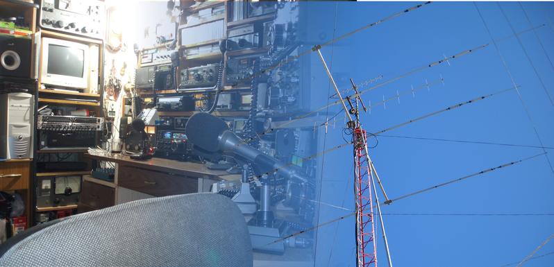
Nikolay "Nick" Zinin, RW6ACM
Progress Station
Antarctica
Russia

[+] Mailing label
Lookups:   5776
Email: Use mouse to view.. QSL: RN1ON - BUREAU OR DIRECT, LOTW


20130307 1425UTC 14022kHz RI1ANP
Date : 06/Mar/2013 1425UTC 
Freq : 14022kHz CW
Rig  : SDR(PI4THT)
ANT  : Mini-Whip(PAØRDT)
PC recording


Tnx fer QSO 73's : )


Lookups5776 (7241)
QRZ AdminRN1ON
Last Update2013-03-03 06:38:31
Class1
Latitude-69.355000 (69° 21' 18'' S)
Longitude76.373333 (76° 22' 23'' E)
Grid SquareMC80ep
Geo SourceUser supplied
Bearing198.7° SSW (from JJ5IZX)
Distance7671.2 mi (12345.6 km)
Long Path17185.6 mi (27657.6 km)
Sunrise23:56:05 UTC
Sunset14:15:26 UTC
ITU Zone69
CQ Zone39
IOTAAN-016 Antartica
QSL InfoRN1ON - BUREAU OR DIRECT, LOTW
QSL by Mail?Yes (e.g. Will this ham QSL by Postal Mail?)
QSL by eQSL?No (e.g. Will this ham QSL with eQSL?)
Uses LOTW?Yes (e.g. Does this ham useARRL's LOTW ?)
Apply for a new Vanity callsign...


Historical information:
Progress is a Russian (formerly Soviet) research station in Antarctica. It is located at the Larsemann Hills antarctic oasis on the shore of Prydz Bay.

The station was established by the 33rd Soviet Antarctic Expedition on April 1, 1988 and was moved to another place on February 26, 1989 In 2000, work was temporarily halted but it reopened in 2003.

A landing field is located close to the station for air connection with other stations. From 1998-2001 works were performed to transfer transportation operations to Progress from the Mirny Station and make it the main support base for Vostok station.
RI1ANP Online log- updated several times in a month, after receiving information from Antarctica. LoTW update similarly.
RI1ANP qsl card :


CX3TQ(Uruguay) on 20m USB!!!

CX3TQ(Uruguay) on 20m USB!!!


CX3TQ Uruguay flag Uruguay 
JOSE LUIS AMENDOLA CARLI
RINCÓN 39
ROCHA 27000
Uruguay

[+] Mailing label
Lookups:   20103 Ham Member
Email: Use mouse to view.. QSL: IK2DUW

20130307 0950UTC 14193kHz CX3TQ
Date : 07/Mar/2013 0950UTC
Freq : 14193kHz USB
Rig  : KENWOOD TS-870S
ANT  : LOOP
PC recording


Lookups20103 (25570)
QRZ AdminCX3TQ
Last Update2013-02-05 11:21:43
Latitude-34.481893 (34° 28' 54'' S)
Longitude-54.339695 (54° 20' 22'' W)
Grid SquareGF25tm
Geo SourceUser supplied
Bearing100.6° E (from JJ5IZX)
Distance11960.8 mi (19249.0 km)
Long Path12896.1 mi (20754.2 km)
Sunrise09:29:35 UTC
Sunset22:07:28 UTC
QSL InfoIK2DUW
QSL by Mail?Yes (e.g. Will this ham QSL by Postal Mail?)
QSL by eQSL?Yes (e.g. Will this ham QSL with eQSL?)
Uses LOTW?Yes (e.g. Does this ham useARRL's LOTW ?)
Admin For(1) CX3TQ
Apply for a new Vanity callsign...


ZF2EL(Cayman Islands) on 20m USB!!!

ZF2EL(Cayman Islands) on 20m USB!!!


ZF2EL Cayman Islands flag Cayman Islands 
Chris A. Vogt

Grand Cayman Island
Cayman Islands

[+] Mailing label
Lookups:   446
QSL: LOTW

20130306 2321UTC 14271kHz ZF2EL
Date : 06/Mar/2013 2321UTC 
Freq : 14271kHz USB
Rig  : SDR(PI4THT)
ANT  : Mini-Whip(PAØRDT)
PC recording


Lookups4468 (4864)
QRZ AdminHB9ELV
Last Update2013-03-04 09:07:24
Geo SourceFrom DXCC
Bearing37.6° NE (from JJ5IZX)
Distance8115.2 mi (13060.1 km)
Long Path16741.7 mi (26943.1 km)
Sunrise11:41:03 UTC
Sunset23:31:41 UTC
ITU Zone11
CQ Zone8
IOTANA-016 Cayman Islands
Born1984
Web Pagehttp://www.hb9ee.ch
QSL InfoLOTW
QSL by Mail?No (e.g. Will this ham QSL by Postal Mail?)
QSL by eQSL?No (e.g. Will this ham QSL with eQSL?)
Uses LOTW?Yes (e.g. Does this ham useARRL's LOTW ?)
Apply for a new Vanity callsign...


IOTA NA-016
QSL: LOTW only
will be on air for the ARRL DX SSB!!!! 73 Chris ZF2EL aka HB9ELV


TX5K(CLIPPERTON ISLAND) on 20m CW-2!!!

TX5K(CLIPPERTON ISLAND) on 20m CW-2!!!


CORDELL EXPEDITION by KK6EK
CLIPPERTON ISLAND
FRENCH TERRITORIES
France

[+] Mailing label
Lookups:   68840
QSL: N2OO


20130306 2306UTC 14033kHz TX5K

Date : 06/Mar/2013 2306UTC 
Freq : 14033kHz CW
Rig  : SDR(PI4THT)
ANT  : Mini-Whip(PAØRDT)
PC recording

http://www.tx5k.org/


Why QRM!!!!!


Lookups68840 (88306)
QRZ AdminF1NGP
Last Update2013-02-02 20:37:27
Latitude10.297025 (10° 17' 49'' N)
Longitude-109.215493 (109° 12' 55'' W)
Grid SquareDK50jh
Geo SourceUser supplied
Bearing65.7° ENE (from JJ5IZX)
Distance7310.7 mi (11765.5 km)
Long Path17546.1 mi (28237.7 km)
Sunrise13:30:06 UTC
Sunset01:27:15 UTC
Web Pagehttp://www.tx5k.org
QSL InfoN2OO
QSL by Mail?Yes (e.g. Will this ham QSL by Postal Mail?)
QSL by eQSL?No (e.g. Will this ham QSL with eQSL?)
Uses LOTW?Yes (e.g. Does this ham useARRL's LOTW ?)
Apply for a new Vanity callsign...


More infos on http://www.tx5k.org


D3AA(Angola) on 20m CW-2!!!

D3AA(Angola) on 20m CW-2!!!

QSL image for D3AA
D3AA Angola flag Angola Mike Koutjumov
near Saurimo
Lunda-Sul
Angola

[+] Mailing label
Lookups:   73692
Email: d3aa@yandex.ru QSL: VIA UA1QV


20130306 2247UTC 14036.8kHz D3AA
Date : 06/Mar/2013 2247UTC 
Freq : 14036.8kHz CW
Rig  : SDR(PI4THT)
ANT  : Mini-Whip(PAØRDT)
PC recording


On-line log here: http://www.clublog.org/logsearch/D3AA
QSL for D3AA via UA1QV, my russian home callsign. Bureau or direct, as you like. ADS for directs: M. Kutiumov, Box 23, Vologda 160000, RUSSIA. LOTW will fill as soon as available and capabilities of the local Internet traffic.
;           ;
CONGRATS!
The first ten, who worked with me at nine bands:
UA4HBW, OK7GU, UA1OIZ, OK2PAY, YU1FW, IT9FGA, OK1EK, YT5Z, UA3TCJ, S57MPU
Excactly QTH is Vila de Catoca (LOC KI00dn) - about 30 km from Saurimo, the capital of the province Lunda Sul Angola. This region is rich with diamonds. I work in Angola as an engineer at the Catoca diamond mine. From here also active Valery D2QV and Vasiliy D2QMN. I am hold basic license . 50 MHz - are not permitted to license.
Antennas for the 9 HF bands are available. The QUAD on the HF, vertical 80 - 10 Inv. Vee 160-80 @ 22 m
While 100 or 300 watts (PA ALS-500M Ameritron)


Angola, officially the Republic of Angola (PortugueseRepública de Angolapronounced: [ʁɨˈpublikɐ dɨ ɐ̃ˈɡɔla];[5]KikongoKimbunduUmbunduRepubilika ya Ngola), is a country in Southern Africa bordered by Namibia on the south, the Democratic Republic of the Congo on the north, and Zambia on the east; its west coast is on the Atlantic Ocean with Luanda as its capital city. The exclave province of Cabinda has borders with the Republic of the Congoand the Democratic Republic of the Congo.
The Portuguese were present in some—mostly coastal—points of the territory of what is now Angola, from the 16th to the 19th century, interacting in diverse ways with the peoples that lived there. In the 19th century they slowly and hesitantly began to establish themselves in the interior. Angola as a Portuguese colony encompassing the present territory was not established before the end of the 19th century, and "effective occupation", as required by theBerlin Conference (1884) was achieved only by the 1920s. Independence was achieved in 1975, after a protracted liberation war. After independence, Angola was the scene of an intense civil war from 1975 to 2002. The country has vast mineral and petroleum reserves, and its economy has on average grown at a two-digit pace since the 1990s, especially since the end of the civil war. In spite of this, standards of living remain low for the majority of the population, and life expectancy and infant mortality rates in Angola are among the worst-ranked in the world.[6]Angola is considered to be economically disparate, with the majority of the nation's wealth concentrated in a disproportionately small sector of the population.

Wednesday, March 6, 2013

KD0JJO/DU7(Philippines) on 20m CW!!!

KD0JJO/DU7(Philippines) on 20m CW!!!


KD0JJO  USA flag USA 
Theodore C Patterson
11293 NW Lake City Rd
Coats, KS 67028
USA

[+] Mailing label
Lookups:   26098 Premium Subscriber
Email: Use mouse to view.. QSL: PREFER DIRECT MAIL TO PHILIPPINE ADDRESS

20130306 1346UTC 14017.9kHz KD0JJO/DU7
Date : 06/Mar/2013 1346UTC
Freq : 14017.9kHz CW
Rig  : ICOM IC-7200
ANT  : LOOP
PC recording

Tnx fer Nice QSO 73's : )


Lookups26098 (30272)
QRZ AdminKD0JJO
Last Update2012-02-22 12:23:33
ClassExtra Codes: HAI
Effective2010-06-14
Expires2019-11-12
Latitude11.088094 (11° 5' 17'' N)
Longitude123.940633 (123° 56' 26'' E)
Grid SquarePK11xc
Geo SourceUser supplied
US StateKansas
Bearing204.6° SSW (from JJ5IZX)
Distance1672.1 mi (2690.9 km)
Long Path23184.8 mi (37312.3 km)
Sunrise21:57:09 UTC
Sunset09:54:22 UTC
ITU Zone50
CQ Zone27
IOTAOC-129 Visayan Islands
Born1938
GMT Offset-6 hours
ULS Record3146440 FCC page...
QSL InfoPREFER DIRECT MAIL TO PHILIPPINE ADDRESS
QSL by Mail?Yes (e.g. Will this ham QSL by Postal Mail?)
QSL by eQSL?No (e.g. Will this ham QSL with eQSL?)
Uses LOTW?No (e.g. Does this ham useARRL's LOTW ?)
Admin For(1) KD0JJO
Apply for a new Vanity callsign...


Currently operating portable from the Philippines as:
KD0JJO/DU7
T.C. (Ted) Patterson
Latitude: 11.09 degrees North; Longitude: 123.94 degees East
Grid: PK11xc
CQ Zone: 27
ITU Zone: 50
IOTA: Oc 129
Philippine Mailing Address for Direct QSLs (preferred):
T.C. Patterson, National Highway-Curvada, San Remigio, Cebu, 6011, PHILIPPINES
Mabuhay!
Free counters!